Scott Schuldt
Artist
An important aspect of my environmentally themed work is that of exploring nature from "the ground up".
Maps in one form or another are frequently found within my artworks. In addition, I make my own hand-drawn maps from my own on-the-ground surveys. I use a home made plane table and alidade (low tech versions of what explorers used when explorers still made maps) and measure distances by pacing. To maintain a state of personal geography, the maps are drawn in units of strides, and include features and objects that I find important.
Maps in one form or another are frequently found within my artworks. In addition, I make my own hand-drawn maps from my own on-the-ground surveys. I use a home made plane table and alidade (low tech versions of what explorers used when explorers still made maps) and measure distances by pacing. To maintain a state of personal geography, the maps are drawn in units of strides, and include features and objects that I find important.

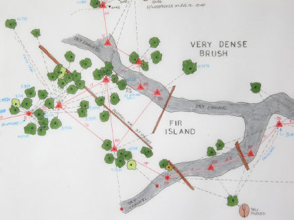
Discovery Park Transect, 36x96 inches, ink on paper, 2009 -540 color coded trees,
total distance about 1 mile-
total distance about 1 mile-
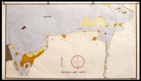
No Man's Land, 36x62 inches, ink and pastel on vellum, 2011

Dalles of the Columbia, 23x45x3 inches, cast animal tracks, acrylic paint


Detail of Outpost Map, 36x48 inches, ink on vellum, 2010